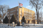
 Located in the Davison County Courthouse, the goal of the Planning and Zoning Office is to attract and promote rural development of residences and businesses in concentrated areas, in an effort to conserve agricultural land. The Planning & Zoning Office issues building permits and 911 Addresses, as well as assists property owners with plats, conditional use permits, and variances.
|
Planning and Zoning
|
Jeff Bathke Email: [email protected] Phone: (605) 995-8615 or (605) 995-8640 Mailing Address: Davison County Courthouse 200 E 4TH AVENUE MITCHELL, SD 57301 |

| Administrator: Jeff Bathke |
Office: (605) 995-8615 or
|
|
| Office Location: Davison County Courthouse, 1st Floor |
|
|
| Email: [email protected] |
Cell: (605) 999-2863 |
|
| Deputy Administrator: Karen Wegleitner |
Office: (605) 995-8615 or |
|
| Office Location: Davison County Courthouse, 1st Floor |
|
|
| Email: [email protected] |
Cell: (605) 299-6059 |
Jeff Bathke
Jeff Bathke has served as the Davison County Planning & Zoning Administrator since April 2013. Jeff is a graduate of Plankinton High School and the University of South Dakota. He holds a Bachelor of Science Degree in Psychology and a Master of Science Degree in Administration, with an emphasis in Organizational Leadership. Jeff’s past experience includes 17 years working as a licensed counselor in the State of South Dakota Department of Corrections facilities, Private Facilities, and Private Research for numerous State Agencies.
Current & Upcoming Events:
- July 1, 2025 Planning & Zoning Commission @ 7:00 P.M.
- July 4, 2025 Courthouse Closed
- July 8, 2025 Board of Adjustment Meeting @ 9:15 A.M.
- July 15, 2025 Drainage Board Meeting @ 7:00 P.M.
- August 5, 2025 Planning & Zoning Commission
- August 12, 2025 Board of Adjustment Meeting
- August 19, 2025 Drainage Board Meeting
The Planning Commission Minutes can be found @ Planning Commission Minutes
Planning & Zoning
![]()
Over the last couple of years, the Planning and Zoning Department has worked on the largest project ever in Davison County, a $505 million Soybean Processing Plant, which is the second largest investment in the State of South Dakota. To learn more about this project, view the High Plains Processing Presentation.
Since May 2025, the Department has been working with the Development Corporation, the State of South Dakota, and several other agencies on a possible prison in rural Davison County. To learn more about the prison, click on the following links:
Davison County Prison Information
The Planning Commission will meet the first Tuesday of the month @ 1:15 PM during the months of December-March and @ 7:00 PM April-November.
In 1999, Davison County adopted the Davison County Comprehensive Plan (1999), which was recently updated as the Davison County Comprehensive Plan 2021-2040.
Davison County adopted a temporary Zoning Ordinance on April 29, 1996; with a permanent Ordinance adopted on April 1, 1998. Since then, the Ordinance has been amended nine times; March 7, 2000, October 24, 2000, December 14, 2004, November 15, 2005, April 1, 2008, January 16, 2009, August 14, 2009, May 11, 2010, July 11, 2017, and this amendment passed on June 8, 2021, with an effective date of July 3, 2021.
Each time any property in the county is rezoned, or the Davison County Zoning Ordinance is in need of a revision, the ordinance and Zoning Map is amended. The Zoning Ordinance explains the different zoning districts, as well as the permitted principal, accessory, conditional, and prohibited uses and structures for each district. Planning & Zoning is always accepting recommended changes to the Zoning Ordinance.
Zoning issues inside the city limits of Ethan, Mt. Vernon, and the City of Mitchell should be directed to their city offices. The City of Mitchell also has jurisdiction over the Extraterritorial Jurisdiction District, which is the one mile outside the Mitchell city limits, as shown on the Zoning Map. Therefore, all building permits, conditional use permits, and variances for these areas are administrated by the City of Mitchell. You can contact them by email @ Mitchell City Planner or by phone @ (605) 995-8433.
If you are planning a project that requires a setback from a residential structure, the following maps have been developed:
1,000′ Setback View
1,320′ Setback View
1,500′ Setback View
2,640′ Setback View
5,280′ Setback View
Any permanent structures will require a Building Permit Application prior to construction. This is to ensure your project meets the required setbacks and other terms of the ordinance. Fees for building permits vary for the different types of construction, so please reference the Fee Schedule 2025 or contact the Planning & Zoning office for the appropriate fee. An accessory use or structure can only be added after a principle use or structure is constructed on the property. Municipal Building Permits will be issued from the respective Municipality. Applicants desiring to rezone property must complete the Rezoning Application.
All projects requiring building permits must begin the project within 180 days from the date of the building permit. Failure to do so will render the building permit void and require the property owner to start over with the building permit process and pay the applicable fees. If the project has been started within the 180 days, but at the end of two (2) years the project is not substantially completed, said permit shall expire and be canceled by the Zoning Administrator with notice that further work as described in the canceled permit shall not proceed unless, and until, a new building permit is obtained. An extension can be requested for special circumstances. A list of current Building Permits, by Taxable Year, can be found @ 2026 Rural Building Permits as of 7-1-25. For previous years’ Building Permits, click here.
All requests for conditional uses or structures must complete a Conditional Use Application. Any structure that does not meet the minimum size or setback distance will require a Variance Application. All prohibited uses and structures for each district are those not listed as a permitted principle, permitted accessory, or conditional uses. However, a classification of unlisted uses is available on the basis of similarity, for the approval of a conditional use. Please see the Fee Schedule 2025 or contact the Planning & Zoning Administration office for the appropriate fee. Be sure to review the Planning & Zoning Deadlines-2025 & 2026 to be sure your application is received in time to be published and heard at the next meeting.
The Planning Commission will make a recommendation to the County Commissioners, acting as the Board of Adjustment, on all Conditional Use and Variance Applications. The Board of Adjustment will make the final decision at the regularly scheduled County Commissioners meeting, normally the Tuesday after the Planning Commission Meeting. All Commission Meetings begin at 9:00 AM and Board of Adjustment will normally meet at 9:15 AM.
The Planning Commission will make a recommendation directly to the County Commissioners on all Appeals, Amendment or Change in Zoning, Plats, Comprehensive Plans, and Tax Increment Financing Districts. TIFD Guidelines can be accessed at Davison County TIF District Guidelines. Please see the current Planning Commission Agenda for the date and time of the next meetings. The past Planning Commission Minutes and Board of Adjustment Minutes are also available for your review.
The 911 Rural Addressing Ordinance was adopted on July 1, 2008; in an effort to maintain the integrity of the established E-911 Addressing system. The system follows the 911 Addressing Handbook and was designed to allow more accurate and timely response of emergency services to life threatening situations.
For a new development, the Developer may make suggestions as to possible names for the road. However, not all requests may be in the best interest of Emergency Management and may not be approved. Road Name requests will consider name duplication and similarity, which may hinder Emergency Services dispatched.
A Road Name Permission Slip must also be completed and approved by the Local Emergency Planning Commission. For all new rural addresses, applicants must complete the 911 Rural Addressing Application. It is important to note basic utilities are not able to be run to the property until a 911 Address has been established. The Planning & Zoning Administrator will determine the address. Once an address is assigned, a 911 Address sign will be created for the property. Please see the Fee Schedule 2025 or contact the Planning & Zoning Administration office for the appropriate sign fees.
The 911 address Sign & Post Placement shall be located within 10 feet of the driveway and within 1.5 feet of the right-of-way line or fence, on the right-hand side of the driveway. The delineator post shall be driven into the ground at least 2.5 feet, with the sign at least 4 feet above ground level.
For small developments effort will be made to also have all addresses on the road-sign post at the main entrance to the development. If you are installing a new driveway, you will need to complete the Approach Application, which will need to be taken to the County Highway Shop on West 5th Street along with a $25 fee. Please read the application close to review what the process and costs are. If you live on a township road, contact your Township Board Members 2025 for approval, and to see if they cover any of the costs. If you are placing a dragline in the right of way for distribution of manure, you must complete a Manure in Right-of-Way License.
The Davison County Plat Procedure explains the process of developing a plat, which is a map, or representation on paper of a piece of land subdivided into lots, parcels, tracts or blocks, including streets, commons, and public grounds, if any, all drawn to scale. The original document must be drawn on a mylar type material. Every addition or subdivision within Davison County shall be uniquely named, in accordance with Sections 1106 (E) and 1305 (B) of the Davison County Zoning Ordinance. The plat shall be presented to the Planning and Zoning Administrator for consideration before the Planning & Zoning Deadlines-2025 & 2026. Please see the Fee Schedule 2025 or contact the Planning & Zoning office for the appropriate plat consideration fee.
All new plats will require an Agricultural Use Covenant Running with the Land, which is an agreement between parties that adjacent land may be subjected to conditions resulting from agricultural operations. This agreement, once executed, runs with the land and cannot be removed. The Planning and Zoning office can help provide you with the necessary Agricultural Covenant papers. If the parcel is within the Ethan, Mt. Vernon, or Mitchell city limits; the plat needs to be approved by the respective City Council. All rural plats will be heard by the Planning Commission and final approval by the County Commission. If the plat is within the designated 3-mile area from the corporate limits of the City of Mitchell, the Mitchell City Planning Commission must also approve the plat. Refer to the Mitchell City Planning Office for further details @ (605) 995-8433.The Mitchell City Planning Office is located inside City Hall.
An approved plat may not be filed at the Register of Deeds without the signature of the County Treasurer; who certifies that taxes, special assessments and advanced taxes are paid in full for the current year and any past years for the parcel being platted, and the parcel the plat is coming out of; commonly referred to as the parent parcel.
Tax Increment Financing Districts (TIF)
A Tax Increment Financing District allows a developer to use the new property taxes generated to pay for the infrastructure to develop the property. A Tax Increment District is a contiguous geographic area within a City and/or County defined and created by resolution of the governing body. The Tax Increment Base Value is the aggregate assessed value of all taxable property located within a Tax Increment Finance District on the date the district is created. The increment, which will be used to pay the note or other funding obligations, is the new property or real estate tax that will be collected due to the new development. More information can be found below:
0-Table of Contents
1-Davison County TIF District Guidelines 12-13-2022
2-2017 TIF Annual Report-DOR
3a-Resolution #082322-01—Discretionary Formula
3b-Commission Minutes 8-23-2022-Discretionary Resolution
4-Sample Resolution to Set Boundaries
5-Sample Resolution to Accept the Project Plan
6-Sample Resolution for Chairman to Sign the TIF
7-Past County and City TIFs
Drainage
![]() The Drainage Board will meet the third Tuesday of the month @ 7:00 PM year-round.
The Drainage Board will meet the third Tuesday of the month @ 7:00 PM year-round.
The originally Davison County Drainage Ordinance was adopted on July 1, 1987, in accordance with SDCL 46A-10A. The ordinance has since been revised, with an effective date of September 24, 2013; and can be found @ Davison County Drainage Ordinance.
The ordinance is intended to provide basic guidance to the county Drainage Commission in carrying out drainage board responsibilities, as well as provide a framework for Davison County landowners to plan and execute drainage activities. Drainage plans should improve the applicant’s land, but also not damage the land of others.
For your convenience, a Drainage Flow Chart was created to assist in understanding the ordinance. The Davison County Commissioners, under Chapter 46A-10A-2 established a Davison County Drainage Commission on October 25, 2011. The Drainage Commission is comprised of two voting County Commissioners and five residents of the county from various locations and backgrounds.
A Drainage Permit Application (Appendix A&B) must be approved prior to any work being started. Upon completion, any new drainage system must be registered with the Register of Deeds, in an effort to protect the landowner’s rights for future drainage repairs. The details of the application will determine if the project can be administratively approved, or if the project will require a drainage permit approved by the Davison County Drainage Commission. They will act on all drainage applications and complaints that are presented for action.
For protection of all past drainage systems rights, landowners were given the opportunity to apply for Vested Drainage Rights prior to 1992. Decisions made by the Drainage Commission can be appealed to the County Commissioners. The County Commission decision can be appealed to Circuit Court.
Please see the Fee Schedule 2025 or contact the Planning & Zoning Administration office for the appropriate fee. Be sure to review the Drainage Deadlines 2025 & 2026 to be sure your application is received in time to be placed on the agenda. The current Drainage Commission Agenda and the recent past Drainage Commission Minutes are available for your review.
During the 1920’s and 1930’s there were twelve County Drainage Systems designed by the State Engineer, after the county was petitioned to form a Drainage District. However, not all were constructed, and several have experienced natural and man-made changes over the last century. Those that were actually constructed were assessed back to the property owners who benefited from the project and are on file with the Planning and Zoning Administrator, who also serves as the Drainage Administrator. These systems are owned by the landowner, are on private property, and are the landowner’s responsibility to maintain the drainage system.
Today, residents can see an open ditch on their property. However, most residents are not aware of the buried drain tile projects that exist on their property, which could result in damage to the drainage system upon any excavation in the area. A PDF of the Drainage Systems, by Township, can be found here.
Flood Plain
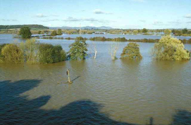
The purpose of the Flood Damage Prevention Ordinance is to promote public health, safety, and general welfare; and to minimize public and private losses due to flood conditions in specific areas. The current Ordinance can be found @ Flood Damage Prevention Ordinance 2025.
The provisions are designed to:
- Protect Human life and health;
- Minimize expenditure of public money for costly flood control projects;
- Minimize the need for rescue and relief efforts associated with flooding and generally undertaken at the expense of the general public;
- Minimize prolonged business interruptions;
- Minimize damage to public facilities and utilities such as water and gas mains, electrical, telephone, sewer lines, streets, and bridges located in flood plains;
- Help maintain a stable tax base by providing for the sound use and development of flood prone areas in such a manner as to minimize future flood blight areas; and
- Ensure that potential buyers are notified that property is in a flood area.
The Davison County Flood Plain Authority is the county/city limit line. Some areas of the county have been mapped, while others have not. The Planning & Zoning Administration Office can assist you with an aerial view of the property using the Geographic Information System (GIS), or the property owner can access the system @ https://www.davisonreports.com/.Click on the “View Map” button.
Extreme restrictions apply when building in a flood plain. Applicants will need to complete the Floodplain Development Permit Application, to include a flood proof plan. The property can also be built up with fill and the soil compacted to rise above the flood plain. A surveyor will be able to determine the elevation required. A map amendment can also be completed, in an effort to remove property from the flood plain. Flood Plain is developed by FEMA and is currently under a major revision of the entire county.
Geographic Information System (GIS)
![]() The Geographic Information System (GIS) integrates hardware, software, and data for capturing, managing, analyzing, and displaying all forms of geographically referenced information.
The Geographic Information System (GIS) integrates hardware, software, and data for capturing, managing, analyzing, and displaying all forms of geographically referenced information.
GIS allows the user to view, understand, question, interpret, and visualize data in many ways that reveal relationships, patterns, and trends in the form of maps, globes, reports, and charts.
You can access the Geographic Information System @ https://www.davisonreports.com/.Click on the “View Map” button.
A detailed explanation of the map system is @ GIS Directions-Website Version for Citizens.
Contact Us
 DAVISON COUNTY COURTHOUSE
200 E 4TH AVENUE MITCHELL, SD 57301
Phone: (605) 995-8615 or (605) 995-8640
Telephone: (605) 995-8615 or (605) 995-8640
Jeff Bathke
email: [email protected]
Cell: (605) 999-2863
Karen Wegleitner
email: [email protected]
Cell: (605) 299-6059